
State of Eritrea is located in the east of the African Continent, with a population of 6,086,495, making it the 107th largest
national population. Its capital and largest city is Asmara with a total population of 649,000. The country encompasses
117,600 square kilometers making it the 101st largest country in total area. It shares boundaries with Sudan, the Red Sea,
Djibouti and Ethiopia.
President Isaias Afworki is recognized as the Chief of State and Head of Government and achieves that status through election
by the National Assembly and holds that position for five years. Its form of government is a transitional government and they
celebrate the creation of their constitution on 19th of May 1993.
The languages commonly or officially spoken are Afar, Arabic, Tigre, Kunama, Tigrinya and other Cushtic tongues. It counts
among its major religions Muslim, Coptic Christian, Roman Catholic and Protestant. As sources of mass communication it has
2 AM, 2 Short Wave and 2 Television stations.
Major geographical features are Soira, its highest point at 3,018 meters and near Kulul within the Denakil Depression, its
lowest point at -75 meters. Its principal waterway is Red Sea, which measures 2,234 kilometers of coastline.
Major industries providing for the bulk of their Gross Domestic Product (GDP) are food processing, beverages, clothing and
textiles, light manufacturing, salt and cement. Its official currency is Eritrean Nakfa.
Here’s something you may not know about Eritrea. Located at a strategic geopolitical position along the world's busiest
shipping lanes, Eritrea retained the entire coastline of Ethiopia along the Red Sea upon de jure independence from Ethiopia on
24 May 1993.
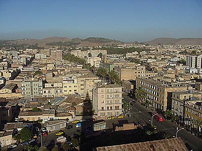
| Asmara- Eritrea's capital and largest city |
| Kulul in the Denakil Depression- Eritrea's lowest point |
| Baobab tree just outside of Keren |
| Elephant in Semenawi Bahri National Park |
| Eritrean man in traditional church clothes |
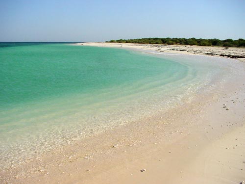
| A piece of the breathtaking beaches of Eritrea near Assab |
| The Eritrean Coffee Ceremony |
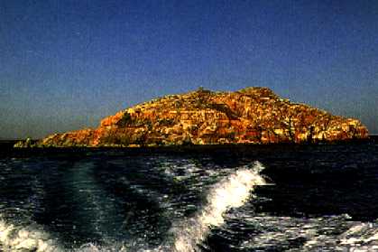
| Bombed war jeep on one of the islands in Eritrea's Dahlak Archipelagos |
| Eritrean railroad bridge |


| Abi's Home Page |
| Back to |
| NEWSPAPERS Pan African News Agency Dehai Eritrea 24 |
ERITREA
Updated 12 February 2013
Updated 12 February 2013


| Adult Prevalence Rate: People Living with HIV/AIDS: HIV/AIDS Deaths: |
0.8% (2009 est.)
25,000
1,700
25,000
1,700


| Eritrean traditional food- zigni (meat with chile peppers), injera (flat bread), hilbet (fava bean and lentil paste) and shiro (pea soup) |

| Soira- Eritrea's high point towering above the village of Nakfa |


| Mountains above Debre Bizen Monastery |

| Nacfa in Sahil- Eritrea's northernmost point om the border with Sudan |

| Om Hajer- Eritrea's westernmost point on the border with Ethiopia |
| Resort in Massawa on the Red Sea |

| Salt Pans at Assab- Eritrea's southernmost point on the border with Djibouti |
| Seil Island in the Dahlak Archipelago- Eritrea's easternmost point |
Read about human rights in Pax
Gaea World Post Report!
Gaea World Post Report!

| Hamish Islands- a disputed chain in the Red Sea split with Yemen |

| Keren- Eritrea's second largest city |

| Tio- along Eritrea's Red Sea Coast |

