
| SURINAME Updated 16 September 2012 |
Republic of Suriname is located in the north of the South American Continent, with a population of 560,157, making it
the 170th largest national population. Its capital and largest city is Paramaribo with a total population of 244,946. The
country encompasses 163,270 square kilometers making it the 91st largest country in total area. It shares boundaries
with the North Atlantic Ocean, French Guiana, Brazil and Guyana.
President Dési Bouterse is recognized as the Chief of State and Head of Government and, along with Vice President
Robert Ameerali achieves that status through a two-thirds majority vote of the National Assembly and holds that
position for a five-year term with no term limits. Its form of government is a constitutional democracy and they
celebrate the creation of their constitution on 30th of September 1987.
The languages commonly or officially spoken are Dutch, English, Sranang Tongo, Hindustani and Javanese. It counts
among its major religions Hindu, Protestant, Roman Catholic, Muslim and indigenous beliefs. As sources of mass
communication it has 4 AM, 13 FM, 1 Short Wave and 3 Television stations.
Major geographical features are Juliana Top, its highest point at 1,230 meters and an unnamed location in the Coastal
Plain, its lowest point at –2 meters. Its principal waterway is the North Atlantic Ocean, which measures 386
kilometers of Coastline.
Major industries providing for the bulk of their Gross Domestic Product (GDP) are bauxite and gold mining, alumina
production, oil, lumbering, food processing and fishing. Its official currency is the Surinam Dollar.
Here’s something you may not know about Suriname. Suriname is the smallest independent country on the South
American continent. It is mostly tropical rain forest with a great diversity of flora that, for the most part, is
increasingly threatened by new development.
| Cappename River |
| Marowijne River which forms the border between Suriname and French Guiana |
| Galibi National Park |
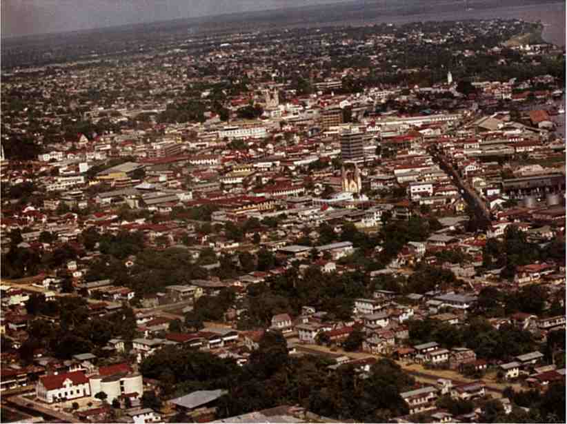
| Paramaribo- Suriname's capital and largest city |
| Rainbow at Voltzeberg National Park |
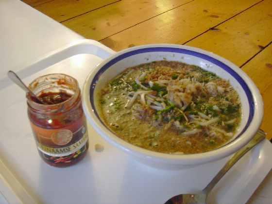
| Sauto Soup- A Suriname favorite of dark chicken, cabbage, fried potatoes and boiled egg |
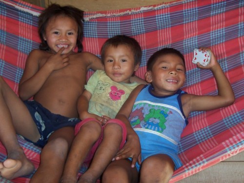
| Suriname children |
| Tafelberg National Park |
| Sipallwini National Park |


| Abi's Home Page |
| Back to |
| NEWSPAPERS De Ware Tijd Dagblad Suriname De West |
| WJ van Bloomenstien Lake |


| Albina on the Marowijne River- the crossing point from French Guiana into Suriname |

| Courantyne River on the Suriname's border with Guyana |

| Sunset on Brokopondo Lake |

| Coastal Plain- Suriname's lowest point |

| Kwamalasamutu- an indigenous village in southern Suriname |

| Nieuw Nickerie- on Suriname's western coast |

| Juliana Top- Suriname's highest point |

| Benzdorf- a mining community on Suriname's border with French Guiana |

| Tafelberg Falls |

| Shaman of the Trio People |


Read about human rights in Pax
Gaea World Post Report!
Gaea World Post Report!

| Adult Prevalence Rate: People Living with HIV/AIDS: HIV/AIDS Deaths: |
1% (2009 est.)
3,700
less than 200
3,700
less than 200

| Maripa Falls- Suriname's easternmost point on the border with French Guiana |

| Matapica- Suriname's northernmost point on the Atlantic Ocean |

| Sipaliwini Nature Reserve- Suriname's southernmost point on the border with Brazil |

| Wonotobo Falls- Suriname's westernmost point on the border with Guyana |

